Port and harbor surveillance is more complex than a shoreline camera network. Ports combine berth operations, navigation channels, landside freight movement, waterside exclusion zones, and a mix of public and private stakeholders. A useful surveillance architecture therefore has to support both maritime operations and security awareness across a large, mixed-use environment.
MARAD and USCG materials both point to that complexity. Ports are intermodal gateways, not isolated waterfront sites, which means waterside sensing should be connected to how vessels move, how cargo flows, and how security incidents are escalated.
Ports Need More Than One Security Picture
A port surveillance system usually needs to support several simultaneous views:
- harbor and approach awareness,
- berth and anchorage monitoring,
- restricted-zone and waterside perimeter protection,
- and incident coordination with port operations, security, and external authorities.
Those views overlap, but they do not ask the same questions. A traffic-management team may care about safe movement and route adherence. A security team may care about anomalous loitering, waterside approach to critical assets, or activity near restricted infrastructure.
A Practical Port Surveillance Stack
The table below is a synthesized planning aid.
| Layer | Main role in a port or harbor | Common mistake |
|---|---|---|
| Waterside radar and tracking | Maintains awareness across approaches, anchorages, and restricted waters | Designing only for open-water range while neglecting berth and breakwater geometry |
| EO/IR confirmation | Supports classification, evidence, and close-in monitoring near assets | Expecting optics to provide broad harbor search by themselves |
| Traffic and vessel context | Adds cooperative information and operating status | Splitting traffic and security data into separate workflows |
| Operator platform | Applies rules by zone, asset, and incident type | Treating every vessel event as a generic alarm |
The IMO VTS framework is useful because it highlights exactly where enhanced service matters most: access channels, port approaches, dense traffic zones, and difficult waters. Port security programs add another layer by focusing on berths, terminals, and critical waterside infrastructure.
The Highest Value Usually Sits Near Interfaces
In many ports, the most valuable surveillance is not in the farthest visible water but at the interfaces:
- channel-to-harbor transitions,
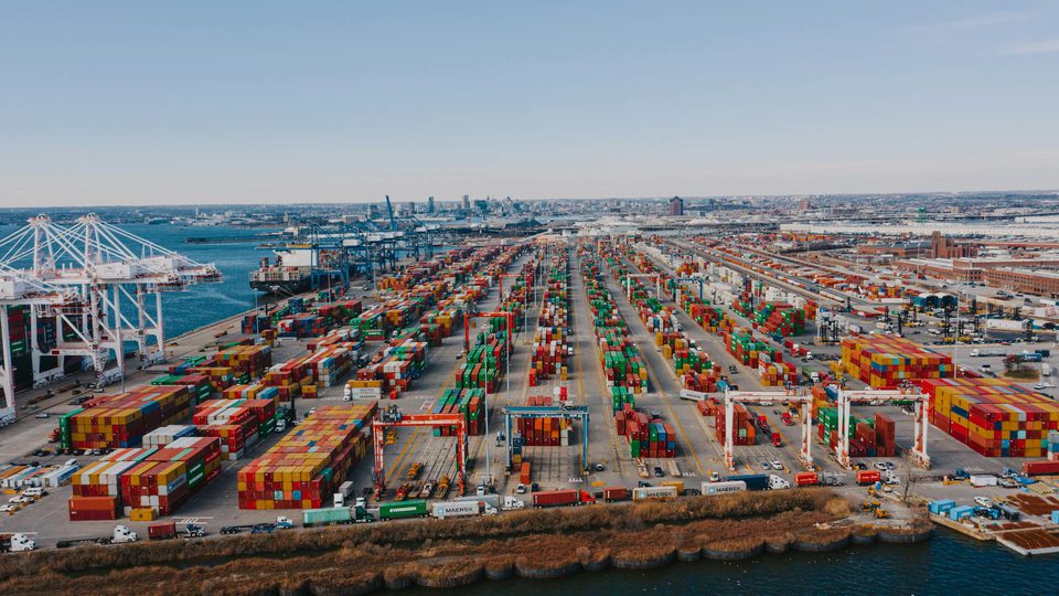
- cargo transfer areas,
- restricted berths,
- and waterside approaches to critical port infrastructure.
Those are the zones where safety, security, and operational tempo intersect. That is also where a disconnected architecture fails fastest.
The Port Should Work from One Common Picture
When radar, optics, vessel data, and incident logs are separated across different rooms or consoles, operators lose context. A better design keeps one operational picture and lets different port users apply different business rules, overlays, and escalation criteria.
Port Geometry Changes Sensor Value
Ports are rarely open semicircles of water. Breakwaters, cranes, container stacks, bridges, ferries, and berth infrastructure all change what a sensor can actually contribute. A radar that looks strong on an open-water specification sheet may perform very differently once the operator needs awareness near berth pockets, inner basins, tug lanes, or channel turns. The same is true for optical confirmation. Cameras may be valuable for evidence and classification near gates or restricted piers, but they are not a substitute for broader waterside search in haze, rain, or nighttime operations.
That is why a useful design exercise starts with port geometry rather than only with theoretical range. Teams should ask where vessels transition from routine navigation into security-relevant maneuvering, where small craft can approach infrastructure, and where clutter from legitimate activity is highest. The right answer is often a mix of area coverage for channels and tighter zone protection around high-consequence berths, fuel piers, passenger terminals, or customs-sensitive transfer points.
Safety and Security Need Different Rules on the Same Picture
Many ports already operate traffic-management, pilotage, and marine-safety workflows. Security monitoring does not replace those workflows, but it should be able to sit on top of the same environmental picture. The difference is that safety teams often care about route adherence, vessel spacing, and navigation support, while security teams care about loitering near assets, unauthorized approach, suspicious transfer behavior, or movement in restricted waters.
If the system separates those views completely, operators spend valuable time reconciling whether they are looking at one event or several. A better approach is to maintain one underlying track and zone picture while allowing different user groups to apply different thresholds and escalation paths. That makes it easier to determine whether a slow-moving craft near a berth is a normal operational support activity, a safety concern, or something that merits a security response.
Weather, Tide, and Traffic Peaks Should Be Part of Validation
Port surveillance plans often assume a stable operating environment, but ports are defined by change. Traffic density varies by berth schedule and season. Tide and current alter how vessels maneuver in narrow areas. Weather affects both sensor performance and the pace at which operators can confirm an event. These factors matter because a design that works on a quiet clear day may become far less usable during rain, glare, heavy commercial traffic, or nighttime cargo handling.
Validation should therefore include scenarios that reflect actual operations: harbor approach in poor visibility, crowded tug and workboat activity near an industrial berth, passenger-terminal movement during peak periods, and incidents in which an operator must decide quickly whether behavior is routine or abnormal. Ports do not need perfect information in every moment. They need stable enough awareness to prioritize action when the environment is busy and ambiguous.
The Best Metric Is Better Waterside Triage
A port monitoring system succeeds when it improves triage. That means fewer cases where teams overreact to normal movement and fewer cases where meaningful anomalies are buried in routine traffic. The best outcome is not merely more detections. It is a stronger ability to separate navigation activity, service operations, and suspicious behavior in time to act.
This is also why port systems should preserve context around tracks, zones, and operator notes. A single alert is rarely the whole story. A craft that briefly appears near a berth may be unimportant, but repeated behavior across shifts, terminals, or approach lanes can reveal a pattern. Good surveillance gives the port enough memory to support both real-time response and later investigation.
Conclusion
Port and harbor surveillance is most effective when it is built around operational interfaces rather than around one sensor class or one maximum-range number. Ports need awareness across approaches, inner waters, berth areas, and intermodal transfer points, with safety and security teams working from a coherent picture. The result should be a monitoring architecture that improves waterside triage, supports incident coordination, and remains usable in the geometry and tempo of real port operations.